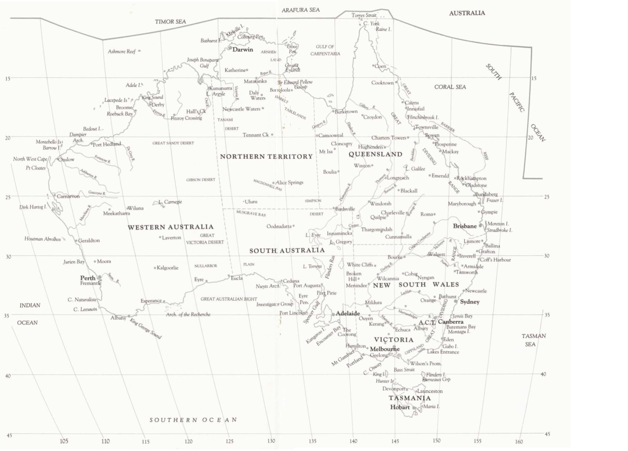
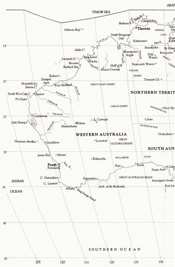
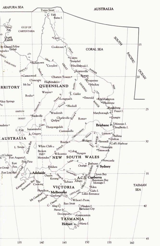
Australian Map
[Inside front cover – from Vol. 2]
Link to full Australian map
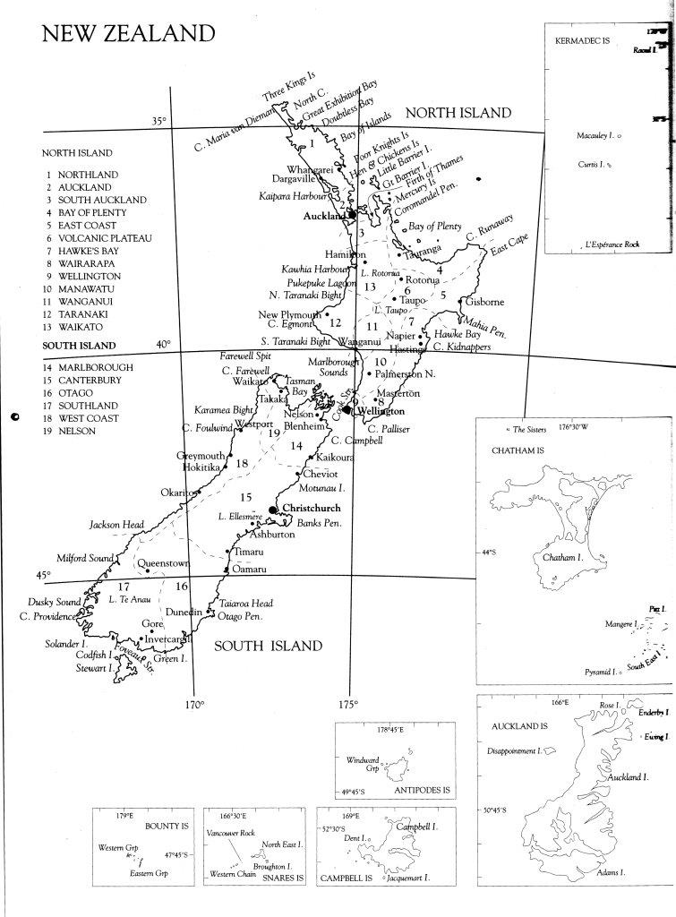
New Zealand Map
[Inside rear cover – from Vol 7]
Antarctica Map also showing HANZAB boundary and Outlying Islands
[ Inside rear cover – from Vol 7 ] See below map for list of Outlying Islands
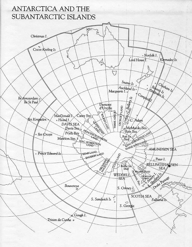
Outlying Islands by country:
- Australia:
- Cocos-Keeling Is
- Norfolk I.
- Lord Howe I.
- Macquarie I.
- MacDonald I.
- Heard I.
- New Zealand:
- Chatham Is
- Bounty Is
- Antipodes Is
- Campbell I
- Auckland Is
- Snares Is
- Balleny Is
- France:
- Illes Kerguelen
- Illes Crozet
- South Africa:
- Prince edward Is
- Norway:
- Bouvetoya
- Peter I Island
- Britain:
- S. Sandwich Is
- S. Georgia
- No country:
- S. Orkney I.,
- South Shetland Is.,
- Anvers I.
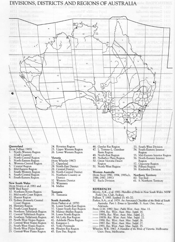
Australian Regions
[Figure 1 from Volume 7b Introduction]
Gazetteer from HANZAB book
Note: Lat/long appear to be incorrect in at least some cases (eg. Adelaide).
Part 1. Australia to Renmark
View PDF in browser or Download PDF to open outside your browser.
Part 2. Rest of Australia, New Zealand and Antarctica
View PDF in browser or Download PDF to open outside your browser.
Online Gazetteers
Online gazetters are available but may not contain all locations referenced.
Australia
New Zealand
Antarctica
Leave a Reply
You must be logged in to post a comment.